Thursday, January 20, 2011

Assignment 10: Multivariant Visual

Multivariant Visual

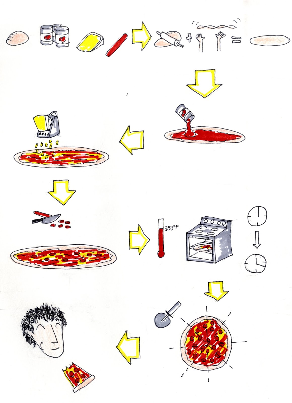
For our final assignment for this intersession, our class was to create a multi-variant visual that combined the different types of visuals we learned in class. The requirements were to include a mind map, explanation graphic, charts, graphs, and a process diagram. Since the topic was of our choosing, I decided to do something I would like and where I already knew I could easily find information on so I picked skiing in Vermont. Most of the information required was the mountains website however some information was gather from another website I use for snow information or general information I gathered from years of skiing. The first element I did was the explanation graphic which was to show each mountains location within Vermont. The interesting pattern that emerged out of this was how the mountains clearly showed the spine of the Green Mountains that run through Vermont. While not really shown within the multi-variant visual itself, I used a mind map of skiing to decide what are important factors within a mountain that a skier would look at. While I had many branches, the four important quantitative ones I came up with where that of snowfall, lift ticket price, vertical, and trail count. Next, using the list as my base, I created four graphs of information that a skier would find important for skiing such as snowfall, lift ticket prices, the vertical, and number of trails on the mountain. I tried to keep these graphs lined up with the mountain list so the viewer could compare the different elements as a whole but also quickly find information for only one particular mountain. Once again, due to the organization being based on geographic location from north to south, certain patterns emerged such as the snow fall chart which snowed more snow in the northern resorts compared to the southern resorts and the vertical graph which showed an almost cross section like visual of the Green Mountains. Under each of these graphs I included charts which arranged the data from highest to lowest which would make it easier for the viewer to find the most and least of the information. In order to make the graphs and charts read as one for the same topic I included a very faint bar of color that connected the chart and graph so the information could be read separately from topic to topic. While the charts and graphs were used to explain the quantitative data, I used a process chart to show the qualitative elements that came out of the mind map for the resorts that could not really be expressed within charts and graphs. The chart shows certain characteristics found within resorts such as, family resort, terrain parks, and challenging terrain, and then showed mountains that had this characteristic. This was to be seen as something that allowed the viewer to quickly choose a mountain without having to look through all the data within the charts and graphs.
Overall I found this assignment to be very fun but much more work than any previous assignment. Not only did we have to do multiple charts, graphs, and visuals but since a multi-variant display was to show an overall idea, I felt that the layout and transition between different visual was very important to create a cohesive multi-vartiant display. As a final assignment for the class, I felt this assignment tested me on all the information I learned within this short semester into one complete package.

Wednesday, January 19, 2011

Assignment 9: Storyboard


Storyboard 1: The Fire


Storyboard 2: The Shot
For this assignment the class was told to create two storyboard using three photos out of a series of photos from the photographer Will Yurman. Each storyboard was to contain four images that told a story, one story board which used one photo from Will Yurman, and another storyboard that linked two photos by Will Yurman. To fill in the other photos for the storyboard I decided to use Google Images instead of sketches so that the storyboard would look more cohesive and continuous. For the first storyboard I used the photo of the four people with smoke mask walking out of a hazy fog. When looking at this image, I was reminded of the forest fires in California a few summers ago and based my storyboard off of that. The story starts with lightning striking a forest, a fire starting, firefighters fighting the fire, and then finally the people leaving the smog created by the fire. In what we learned from class today about story board transitions from Scott McCloud, I choose the follow the action to action transition in that it allowed the story to flow over a longer period of time. The photos also all contain a similar point of view of looking at a fire on a hillside in the upper left corner of the frame which gives this storyboard a degree of moment to moment although the time between these moment is a bit longer than it should be. The following storyboard I decided to use the photos of the 4 little kids playing soccer and the man praying. While these two images seem rather unrelated I though of the suspense in soccer games like during the World Cup from this summer and how ordinary people get very into the game. The story for this was for one of the kids on the team to get a penalty, the team creates a wall to help block the shot, at this highly intense moment the man praying shows the anxiety, and then finally the shot being scored. Again for this storyboard I decided to use the action t action transition in that it helped break up all of the moments that happen with a penalty shot in a soccer game. Since all of these events are taking place at the same soccer field, the storyboard also contains some degree of aspect to aspect transition as the perspective changes around the soccer field.
Once again, I found this assignment to be fun and interesting. In following the advise given to the class, I simply tried focusing of the first thing that the photo made me think of and based the story around those ideas and I found that this made it easier to come up with a story. Probably the hardiest part of this assignment was finding images on Google Images that fit within the same context as the story such as finding pictures that had the same color scheme and similar context. I feel that this was best displayed within the fire story as each image is of similar perspective and all have a similar orange and red color pallet.

Tuesday, January 18, 2011

Assignment 8: Charts and Graphs


For this assignment the class was asked to create a chart and some sort of graph to display information and statistics that pertain to Roger Williams University. After the new year, Facebook had several applications that created interesting visuals for Facebook stats like most used words for status updates, places visited, etc. and I decided to make a visual for the locations within New England of my Roger Williams friends. While this might not actually be important information for the school itself, I thought it would be interesting way to display a fun fact for me. After searching through a random selection of 100 friends from Facebook I simply counted up the number of friends from the various states of New England with Massachusetts claiming the most with 38, next Connecticut with 18, Rhode Island with 10, New Hampshire with 9, and Vermont and Maine tied in last with 5 while 16 friends were from other states outside of New England. For the table part of our assignment I decide to list the states in descending order in order to show the significance of which states had the most amount of friends. Next step was to take this information from the table and make a graph of some sort. During class we looked at several different options such as bar graphs, line graphs, and pie charts however I thought of making a graph that used the shapes of the states. For this graph I took each state, making sure they were the all the same size, and scaled them appropriately based on the amount of friends from each state in Adobe Photoshop. In order to also show the difference between states with more friends than others, I added a transparency to the states with fewer friends so they would look more faded compared to states with more friends. Finally I added labels for the states as well as the number of friends from each state. Since I had space at the bottom of the graph, I added the chart as well to add additional information for the graph and create a more cohesive presentation.
Overall I enjoyed this assignment in that it allowed us to show different means of presenting data and statistics however I am not completely happy with my results. The final graph that was created did not come out as I had pictured it in my head, which was mainly due to the different shapes and sizes of the states. While looking at a map, we inherently know that a state like Maine is larger than a state like Rhode Island so when I re-scaled the states in order to represent the number of friends from that state, it threw off the viewer when looking at the map. Also, in the case of Massachusetts, Connecticut, and Rhode Island, the re-scaled states maintained a similar scale and proportion of the actual states and therefore do not read as the data would in a chart. What was interesting while using this graph was a pattern of a majority of friends are from southern New England rather than Northern New England and is something that I do not think would show in another type of graph. Overall a bar graph would have better displayed the information but I kept the state graph mainly due to my aesthetic appeal to it.

Friday, January 14, 2011

Assignment 7: Flow Chart


Flow Chart for Amazon.com
 So for this assignment, the class was told to create a flow chart of how to order a book from amazon.com. To start this assignment, I actually went on amzaon.com and wrote down the steps I took as I pretend to buy a book from the website. The first steps I took were asking the viewer if they knew any information about the book they are looking for and if so to enter it into the search bar as this would be the quickest way to find the book. If they did not know any information, I thought the next logical step would be to either browse through the book selections or to find more information about the book the viewer needed and to return. After the initial searching for the book, the next step was to select the book from the options of books presented. From this point on with the checkout process, amazon.com would ask the customer simple questions such as asking if the customer wants more books, asking for billing/ shipping information, and asking if the book is a gift. While this appears to be extra steps for the checkout process, it seems as though amazon.com is trying to get the customer to buy more items by advertising them to the customer. When making the flow chart, I tried to keep these steps as processes rather than decisions because I felt that when even someone who has never been to the website would simply proceed through these rather than treat each step as a decision. For example if some one’s shipping information is different than their billing information, amazon.com ask the customer this question and allows the customer to fill out the different information but for the flow chart, I simply kept this under one process since filling out the separate information never takes one to another page. After these steps I terminated the flow chart with logging the viewer off and having them wait for the book. In an earlier sketch I had more processes and decisions in the flow chart, but I choose to omit these, as they seemed to use more ink and not really have much of an impact on the flow chart. Also after looking at the flow chart examples in class, I tried to add some humor elements into the flow chart even if they added extra or unnecessary steps because I felt it added elements that makes the viewers experience through the flow chart better. I also attempted to maintain the proper format for the final flow chart by making sure that I had the proper symbols, arrows, and non-overlapping lines in order to prevent any confusion.
I found this assignment to be both easy at times and hard at times. The easy parts where, well simply writing down the steps of simply buying a book from amazon.com. The more difficult parts of the assignment were figuring what to make a process and what to leave as a decision. I felt this way because I tried to keep the steps required to a minimum however I needed to make sure that all options were accounted for.

Thursday, January 13, 2011

Assignment 6: Photographic Analysis

Pillars of Creation (1995)

This assignment seemed to be a tricky one. For assignment 6, we were told to find an iconic photograph and critically analyze it. Now I may have a small background in this but it still seems like a difficult task. After roaming the Internet for a while looking at various iconic photograph lists, one that truly stuck out to me was Pillars of Creation (1995) captured by the Hubble Telescope. The photo itself is nothing more than three large pillars of clouds in space but I found this to be the most interesting out of all the others. For this assignment we were told to use Lester's six perspectives of personal, historical, technical, ethical, cultural, and critical as well as to use the structures of the golden spiral and the rule of thirds. Starting with the six perspectives, the personal perspective of this image was that space simply amazes me. It's something completely different because it something that we cannot fully relate to. I also found this photo to be interesting in its color use and the back lighting of the cloud masses. The cultural perspective of the photo is that there is a certain symbolism of our planet and the greater whole of the universe. Although they seem like scale-less clouds, the pillars are actually very, very large to the point that they dwarf planets, stars and entire solar systems and it is within these clouds that new planets will, eventually, form. This fact creates a very humbling experience for the viewer in allowing the viewer to know that there is so much stuff out in space that we do not even know about. Out of the six perspectives, these two were the only ones I really understood in relation to this particular image so I really do not know what to say about them. Next I looked at the image in the rule of thirds by dividing the image into a nine square grid. According to the lecture in class, the four intersections that occur around the central square are areas in the image the viewer is most drawn to, particularly the upper left and the lower left. While nothing actually happens at these intersections in the photograph, there are events within the photograph that happen within proximity to these intersections such as the tops of the pillars in the upper intersections and the lower right intersections and a very bright pink start in the lower left intersection. Another visual structure I noticed within the image was the strong diagonal of the rising cloud pillars that starts in the lower right and rises to the upper left. This diagonal movement draws the viewer’s eyes towards the top of the tallest pillar also where the most viewed intersection of the rule of thirds is.
Overall I found this to be one of the more difficult assignments even though it was the least amount of work. I found it difficult to analyze the photograph using the six perspectives, as I did not really see the connections between the perspectives and the photograph. I did however find the rule of thirds to be interesting in how the intersections lined up with the important elements within the photograph.

Assignment 5: Explanation Graphic

Original Lake Effect Snow Explanation Graphic
Updated Lake Effect Snow Explanation Graphic
For this assignment, we were told to find an existing explanation graphic that is poorly designed and make a better version of it. With all the talk about the snow coming on Wednesday, I spent a few minutes wandering around on snow articles on Wikipedia (http://en.wikipedia.org/wiki/Lake-effect_snow) and found an interesting graphic for how lake effect snow works. According to the overly simple graphic, water evaporates, condenses into clouds, then snows over land. After reading the article, this is not exactly how it works. According to Wikipedia, there are other factors involved for the creation of lake effect snow such as temperature, wind, and certain distances necessary for lake effect snow. After doing this research, I worked out how to take the basic graphic of the water and clouds and adding the missing information so the viewer will hopefully not have to read through the whole article in order to understand the process of lake effect snow. I first started with figuring out what facts were missing from the existing graphic which were the other side of the water mass, the necessary temperature change, the factor of strong winds, and the appropriate distance of water wind need to blow across for lake effect snow to take place. I first drew the original graphic and expanded on it to include the other side of the water mass to show how one side is sunny and clear but the other side is under heavy snow. Next I added in the building cloud mass as it moves across the body of water until ultimately snowing on the other end. Next I added some rippling blue arrows to show the wind. At this point the visual was purely graphic and needed additional information that would only confuse the viewer if displayed graphically. The temperature was written in the water and above the clouds to show the necessary temperature change for lake effect snow, I also showed the heights in feet of where this temperature change needs to occur, and finally I added in the distance of water required for snow and the typical distance over land this occurs. While adding this information in, I converted the metric values found in the article into American measurements so the viewer would have a better understanding of the temperature and distance. During this process I was thinking of the visual about Napoleon's Army's failure at Moscow in how it included several different types of information that were cohesively explained on the visual, so I attempted to include the distances and passing of time for the visual. Although I thought it might not have been entirely necessary, I included four short explanations at the bottom of the graphic that explain what is happening within the graphic.
Overall I thought this assignment was going to be more difficult than it really was mainly because I assumed that it would be hard to find a poorly designed visual that needed to be improved. To my surprise, I bumped into one on Wikipedia, which looks as though someone made without any consideration of the viewer's perspective. Once I read about how the process of lake effect snow works, making what I thought would be a better visual seemed to be relatively easy.

Monday, January 10, 2011

Assignment 4: How to...

How to Make a Pizza

For this assignment, the class was asked to create step by step instructions on how to make a pizza for someone who does not know the English language, thus reducing the instructions to visuals. I started this assignment by figuring out how I would give instructions to make a pizza in words as this will create a structure and outline for the visuals. After looking online for a simplistic pizza recipe, I created an ingredient list and then simple steps of how to make a pizza after that ending with, of course, eat and enjoy. For the next steps I kept our class exercise of simplifying lawn care instructions with a visual and all the work of the previous semester for the same assignment. What I learned from this in class assignment was reducing the written statements to the is essentials. After the written steps, I translated them into visuals that would accurately represent the written steps. Since I had the written steps as an outline, the process of creating instructions was already in motion. Since the use of step numbering was not allowed for the assignment is used an arrow system that flows through the page since arrows are almost always used to show motion or a passing of time within cultures. For the visuals themselves, I wanted to keep them simple and cartoon like in, as in the cheese grading step or the cutting of the pizza into eight slices, order to not bombard the viewer with overly excessive or complicated information. As far as steps that required more information, such as baking the pizza, I tried to keep the time and temperature information also as graphics only using numbers for the temperature. As far as the color scheme, I ended up using warmer colors mainly due to the natural colors of the souse, cheese, and dough. In addition to the warm color scheme I also added gray to add more color for the metal elements within the visuals. I also used the color yellow for the arrows as a form of call to action as mentioned in class several times.
Like all the other homework assignments I found this one to be fun but a little challenging in that how to relay the right about of information in the visual so the viewer will understand the step but will not be overwhelmed and confused by too much information. In order to combat this, I tried to keep only one action in each step and to never combine steps in order to save space. I also made sure that the images clearly displayed the necessary actions. I felt that there was a difference between this assignment and others because this assignment was more about visually communicating something to a viewer, like the other maps, rather than visually representing thoughts within my head, like the collage and mind maps. Overall I enjoyed the assignment and I think I am starting to see the bigger picture of the class and how to visually communicate to others effectively.

Friday, January 7, 2011

Blog 3: Collage

For this assignment, we made a collage using images from various magazines that appealed to us and arrange them in the form of a pattern on a large piece of paper. Using two magazines I brought with me, a Sports Illustrated and an Architecture Boston magazine, as well as two other magazines brought by our professor, I flipped through and ripped out any image that was of something I liked, such as a wave and fish, or anything image that I found interesting regardless of what the actual content was, such as the infrastructure diagram and the odd patterns from a science magazine. I continued this process until the time was up and ended up with several types of images, a wave, a mountain, fish, skylines, nature, coffee, pillows, various forms of art, a blank face, and some graphs. Next I arranged these images into same groupings of what the images meant to me, things of interest (wave, mountain, fish, map, skyline, nature) things of pleasure (art, coffee, sleep, sports) thing of work or profession (architecture, graphs, diagrams) and finally just random images (face, patterns, colors). The first patterns I noticed after the collage was posted on the wall were cool colors, interconnectedness, water, line, art, interest, pleasure, profession, grouping, and descending scale.
After posting my collage on my blog and allowing other students to comment, it appears as though many of the comments agree with each other as well as what I thought about my collage. The patterns that appeared most was a use of water and nature elements, which I feel is most likely due to the upper right hand corner of the waves, plant, fish, and mountains, the use of everyday things and art, which is most likely with the lower half of the collage, and finally a use of darker colors, which is mainly due to the combination of cool colors from the water elements and the dark colors of the lower half of the collage. As far as someone looking at this collage without any knowledge of my intensions, I feel that my collage in a way spoke for itself since most of the comments agreed with both each other and agreed with what I thought about the collage. The comment that stood out to me the most was Geoff’s comment of “There are pictures with ‘everyday use’ objects so that combined with the pictures of nature and idea of travel could make this collage a good representation about enjoying the simple things in life.” Although this was not exactly what I was aiming for while creating the collage, I feel as though it is a very accurate summation of me as a person. I found this to be very surprising that my personality read that strongly through the visual representations of the collage even with it not being my end goal while creating the collage.
Overall I found this exercise to be very fun and useful for visually representing thing we liked. What I enjoyed most about this was how we were thrown in to the assignment with a short amount of time to complete it that it did not actually allow me to think about what I was looking for, which I think may have helped me subconsciously pick what I found appealing rather than spending too much time consciously thinking about what I was picking.

Thursday, January 6, 2011

Assignment 3: Collage

Blog 2: Surf Map


The second assignment was a choice between either creating a concept map of a topic of our choosing or a geographic map of a topic of our choosing. I decided to make a geographic map of the various surf spots in Newport, RI. I choose the geographic map because I felt that it was a stronger visual of the two types of maps because of the use of visuals over the use of words and connections of words. I choose to make a geographic map of Newport but instead of creating a normal map or a road map, I decided to create a surf map. Following the surf culture code of never giving exact directions to surf spots, whether they are secret or not, I kept the map simple only showing basic roads and landmarks that allow the user of the map to find their way to the general area of surf spots but to still allow exploration on the surfer's part to discover the spot for themselves.
I started the map simply by drawing the coastline from memory, having surfed the area for roughly six years now I know the basic outline of the coast especially where the surf spots are located. After the coastline was complete, I added the surf spots in the necessary spots along the coast. In order to show the characteristics of each wave, I drew a character of three waves to display how the wave forms, breaks, and ends at each spot while also showing the heaviness of the break, the size of the wave, and the direction of the wave break (either a left, a right, an A frame, or a mixed beach break).  Next I added in the coastal landmarks that pertain to that certain break such as the golf course next to 19th Hole, the beaches for First and Second Beach, the concrete wall next to Hooter’s, and the Breakers mansion next to Ruggle's as these are very important landmarks for finding the waves. The next landmarks I added were the various landmarks that Newport is known for, and that people who are even slightly familiar with the area will know, such as the Newport Bridge, Thames Street, and Ocean Drive that act to orient the surf spots and surf landmarks to the rest of the city. This allows the viewer to orient the surf spots in relation to landmarks they should be fairly familiar with.
In following with our small exercise in class today of mapping New England, I decided to keep the colors to a four color minimum of green for the land, yellow for the sand beaches, grey to double as rocks and color for the man made constructed objects, and of course blue for the water and waves. In order to not distract the viewer from the most important elements, the waves, I tried to use as little color as possible for the other elements and the coastline by only coloring around the borders. This allows the viewer to get a hint of the proper color and to fill in the uncolored areas with that appropriate color. The final step for the map was to provide small labels to the waves and landmarks that will inform the user but still have the visual be the main focus of the map.
Overall I found this assignment to be very fun and very useful as well since it allowed me to really think about the relations between the surf spots, the coastline, and the landmarks of Newport. It also allowed me to try to give the simplest way to a surf spot without adding too many steps.

Assignment 2: Other Maps

Surf Map of Newport R.I.

Wednesday, January 5, 2011

Blog 1: Mind Mapping


So this will be my first blog entry for my COMM 165: Visual Communications class and I’m not really sure how these blogs are supposed to go exactly but I will write down what I was thinking during our first assignment, Mind Mapping, and what I learned from this assignment. The requirements of the assignment were to create a mind map, a free form, brainstorming outline if you will of a topic or question of our choosing. Since I will be going through a transition of leaving college and entering the “real world” during the next month I decided to focus on one of the many questions I have been asking myself; where do I want to live after I graduate? I found it easy to get a few branches right off the bat such as I would rather live in the city than suburbs and the surrounding landscape that will support my two biggest lifestyles, skiing and surfing. After these initial branches I started getting an idea for what I would like by visualizing things in places I like without trying to focus on that specific place. This led me to add in transportation, culture, jobs, and people to my mind map in which allowed me to also expand on these branches such as I would prefer to walk or ride a bike over using a car for the transportation branch. The next phase of the assignment was to pick one of the branches and do a mind map of that. For this part, I choose the city branch because I felt as though by visualizing what a perfect city would be for me, it would allow the topics to flow more freely.  I found this to allow all the ideas to flow way more quickly than the previous mind map in that most of the branches formed within the first 7-10 minutes of the mind map. After an hour break or so I returned to add a few more branches that I missed within the first go at it.
Overall I found the mind mapping process to be very conducive for brainstorming the possible influenced and answers to my question of where to live after I graduate. The most interesting thing I found was the use of the Gestalt Theory, closure by always leaving a branch empty to allow my mind to find something to fill it. This allowed me to never fully be stumped or blocked on an idea and to continue to allow new ideas to flow. I found a few issues with mind mapping one of which was that I found it difficult to maintain a non-hierarchical order of the mind mapping as tended to focus on certain branches more than others. Another issue was that during the second mind map was that I found myself repeating some of the same ideas I mentioned during the first mind map. I did however, find the process of mind mapping to be not a painstaking process in that it allows for ideas to constantly be formed do to the very flexible and informal structure of the mind map.

Assignment 1: Mind Maps

Mind Map 1: Where to live after school

Mind Map 2: Stuff in a city I want to live in